
Getting Started
RidgeWarbler is an outdoor navigation app designed for activities such as hiking and trekking. You can record routes or save forest locations as coordinates without any additional equipment.

How Do You Start?
To create a route, you can either record it directly or import it from a GPX file.
Recording a Route
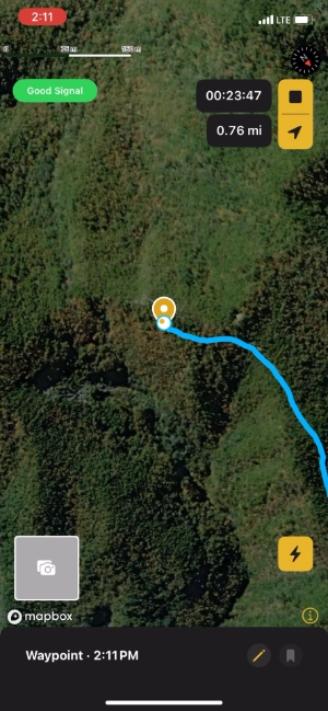
1. Go outdoors where you have a clear view of the sky

2. Tap  at your starting point to begin recording
Start moving while the app is acquiring your location.
3. When you’re done, tap  to stop recording
Map Gestures

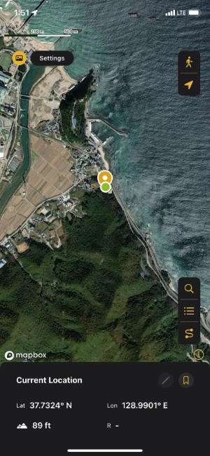
Tap a point on the map to view detailed location information.

Tap the camera icon to add the first photo to a location.

Long-press the photo to add additional images.
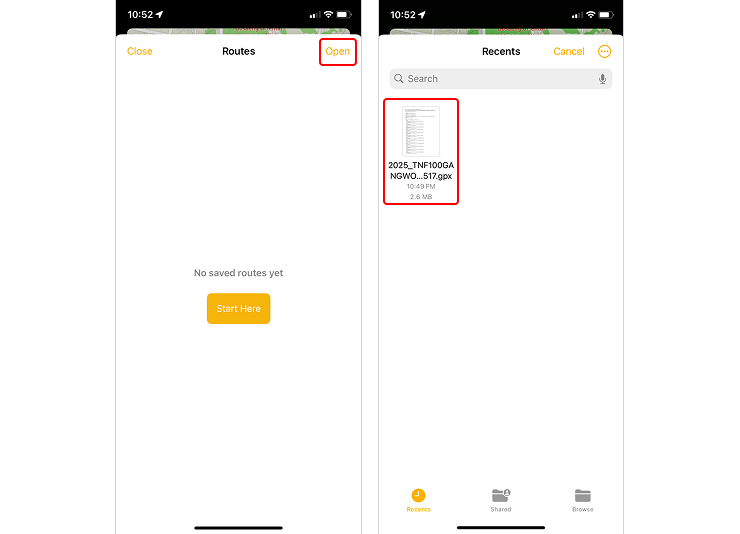
Importing a Route from a GPX File
1. Tap "Open" in the route list
Select a GPX file to import the route.
Features
| Category | Feature | Free User | Subscriber |
|---|---|---|---|
| Route | Import GPX |
O | O |
| Record Route | X | O | |
| Follow Route | X | O | |
| Play Route Animation | O | O | |
| Location | Show Radius | O | O |
| Set Radius Duration | X | O | |
| Add Photo to Location | 1 photo | 12 photos | |
| Search | Coordinate Search | O | O |
| Settings | Map Style Settings | X | O |
| Unit Settings | O | O | |
| Point/Route Color Settings | X | O | |
| Data | Export GPX |
O | O |
Export KML |
O | O | |
iCloud Backup/Restore |
O | O | |
| Export App Data | O | O |
Next post: Saving Locations
📩 For questions, contact [email protected]