
Saving Locations
You can tap the ![]() at a location of interest to save information such as name, color, and photos.
at a location of interest to save information such as name, color, and photos.
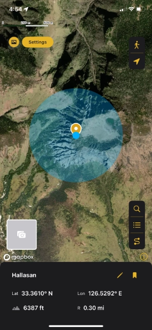
The elevation is automatically measured only at the current user location.
Edit Location
Saved locations will have the edit button ![]() enabled.
enabled.
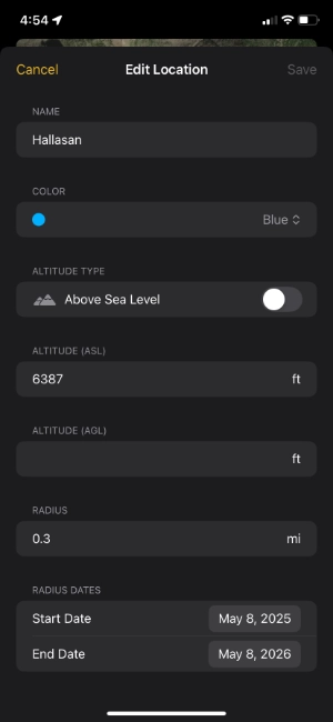
- Altitude Type: Choose which altitude to display
- Altitude (ASL): Used for mountain or location elevation
- Altitude (AGL): Used for drone flight height
- Radius: The radius of the circle drawn around the location
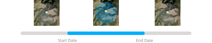
- Radius Dates: Set the duration for the radius circle
📌 Radius circles with expired durations will turn gray.
Next post Searching Coordinates
📩 For questions, contact [email protected]